
Hiking
Hiking
Lost Lake – 2631 elevation, 13.8 miles – moderate hike
This trail is right in our back yard! No need to drive, just walk up the road and take and your first right and your first left. Follow the road up to the trail head.
Lost Lake Trail is a 13.8 mile moderately trafficked out and back trail. You can also go all the way across to Primrose on this trail. This trail features a lake and Dale Clemens cabin that you can rent, which is about 2.5 miles up on the winter trail and 4.5 miles on the summer trail. The trail offers a number of activity options and is best used from May until September. Dogs are also able to use this trail but must be kept on leash.
9 il-persuni tal-post jissuġġerixxu
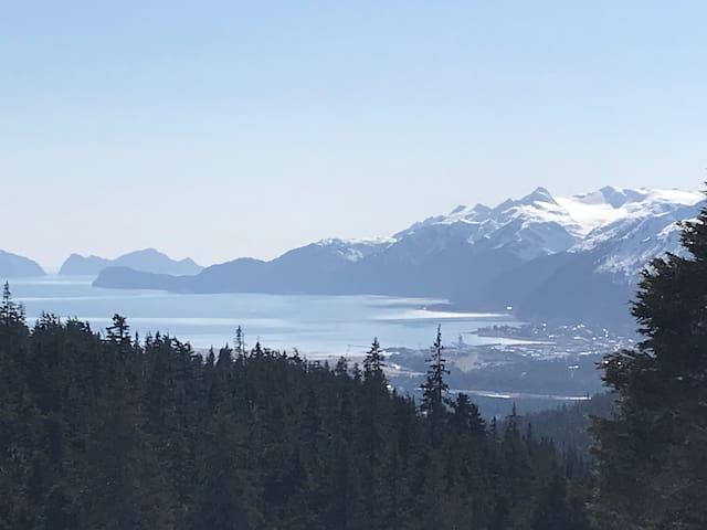
Lost Lake Trail
Lost Lake TrailLost Lake – 2631 elevation, 13.8 miles – moderate hike
This trail is right in our back yard! No need to drive, just walk up the road and take and your first right and your first left. Follow the road up to the trail head.
Lost Lake Trail is a 13.8 mile moderately trafficked out and back trail. You can also go all the way across to Primrose on this trail. This trail features a lake and Dale Clemens cabin that you can rent, which is about 2.5 miles up on the winter trail and 4.5 miles on the summer trail. The trail offers a number of activity options and is best used from May until September. Dogs are also able to use this trail but must be kept on leash.
This trail drops down onto a nice beach area, great place for a picnic.
Tonsina Creek Trail – 734 elevation, 3.4 miles – moderate hike
Tonsina Creek Trail is a 3.4 mile heavily trafficked out and back trail that features beautiful wild flowers and is rated as moderate. The trail is primarily used for hiking, walking, and snowshoeing and is accessible year-round. Dogs are also able to use this trail but must be kept on leash.
9 il-persuni tal-post jissuġġerixxu
Tonsina Creek Trail
Tonsina Creek Trail
This trail drops down onto a nice beach area, great place for a picnic.
Tonsina Creek Trail – 734 elevation, 3.4 miles – moderate hike
Tonsina Creek Trail is a 3.4 mile heavily trafficked out and back trail that features beautiful wild flowers and is rated as moderate. The trail is primarily used for hiking, walking, and snowshoeing and is accessible year-round. Dogs are also able to use this trail but must be kept on leash.
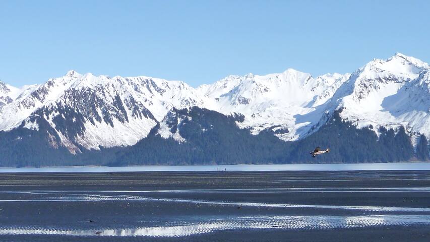
Beautiful views of Seward and Resurrection Bay
Mt. Marathon Race Trail – 2654 elevation, 1.9 miles – harder hike
Race Point via Mount Marathon Race Trail is a 1.9 mile moderately trafficked loop trail that is rated as difficult. The trail is primarily used for hiking and running and is best used from May until September. This trail follows a figure 8 pattern. At the trailhead, proceed UP the right and then left at the junction to the top of Race Point. On your descent, go DOWN left and then right at the junction. This is the race course runners use to complete Seward's Mount Marathon Race. Race Point includes views of the ocean, mountains, and the city of Seward.
Mount Marathon Trail
Mount Marathon TrailBeautiful views of Seward and Resurrection Bay
Mt. Marathon Race Trail – 2654 elevation, 1.9 miles – harder hike
Race Point via Mount Marathon Race Trail is a 1.9 mile moderately trafficked loop trail that is rated as difficult. The trail is primarily used for hiking and running and is best used from May until September. This trail follows a figure 8 pattern. At the trailhead, proceed UP the right and then left at the junction to the top of Race Point. On your descent, go DOWN left and then right at the junction. This is the race course runners use to complete Seward's Mount Marathon Race. Race Point includes views of the ocean, mountains, and the city of Seward.
Ptarmigan Lake – 1059 elevation, 6.8 miles – moderate hike
Ptarmigan Lake Trail is a 6.8 mile lightly trafficked out and back trail that features a lake and is rated as moderate. The trail is primarily used for hiking, camping, and backpacking and is best used from May until October. Dogs are also able to use this trail.
Ptarmigan Lake Trail 14
Ptarmigan Lake Trail 14Ptarmigan Lake – 1059 elevation, 6.8 miles – moderate hike
Ptarmigan Lake Trail is a 6.8 mile lightly trafficked out and back trail that features a lake and is rated as moderate. The trail is primarily used for hiking, camping, and backpacking and is best used from May until October. Dogs are also able to use this trail.
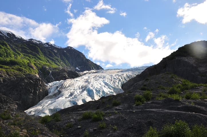
Harding Ice Field – 3641 elevation, 9.2 miles - harder hike
Harding Ice Field Trail is a 9.2 mile heavily trafficked out and back trail that features a waterfall and is rated as difficult. The trail is primarily used for hiking, running, camping, and bird watching and is best used from May until October.
Harding Icefield Trailhead
Exit Glacier RoadHarding Ice Field – 3641 elevation, 9.2 miles - harder hike
Harding Ice Field Trail is a 9.2 mile heavily trafficked out and back trail that features a waterfall and is rated as difficult. The trail is primarily used for hiking, running, camping, and bird watching and is best used from May until October.
Exit Glacier – 308 elevation, 2.2 miles – easy hike
There is a Rangers Station and is a very educational walk. Markers show where the glacier was at points of time. Some of the walk is paved with park benches to rest.
Exit Glacier Overlook Trail is a 2.2 mile heavily trafficked loop trail that features a river and is good for all skill levels. The trail is primarily used for hiking, walking, and nature trips.
12 il-persuni tal-post jissuġġerixxu
Exit Glacier Trailhead
Exit Glacier – 308 elevation, 2.2 miles – easy hike
There is a Rangers Station and is a very educational walk. Markers show where the glacier was at points of time. Some of the walk is paved with park benches to rest.
Exit Glacier Overlook Trail is a 2.2 mile heavily trafficked loop trail that features a river and is good for all skill levels. The trail is primarily used for hiking, walking, and nature trips.
Bear Mountain – 2631 elevation, 3.5 miles - harder hike
Bear Mountain is a 3.5 mile moderately trafficked out and back trail that features beautiful wild flowers and is rated as difficult. The trail is primarily used for hiking, walking, nature trips, and bird watching and is best used from May until September.
Bear Mountain Trail
Bear Mountain TrailBear Mountain – 2631 elevation, 3.5 miles - harder hike
Bear Mountain is a 3.5 mile moderately trafficked out and back trail that features beautiful wild flowers and is rated as difficult. The trail is primarily used for hiking, walking, nature trips, and bird watching and is best used from May until September.
Mt. Alice – 2975 elevation, 4.9 miles – harder hike
This is another hike that has beautiful views of Seaward and Resurrection Bay. It also has a lovely view of the only gated community in Seward, Spring Creek Correctional Center. This hike is our son Jaden’s favorite in Seward.
Alice Mountain Lookout is a 4.9 mile lightly trafficked out and back trail that features a great forest setting and is rated as difficult. The trail is primarily used for hiking and nature trips and is best used from May until October.
Mount Alice
Mt. Alice – 2975 elevation, 4.9 miles – harder hike
This is another hike that has beautiful views of Seaward and Resurrection Bay. It also has a lovely view of the only gated community in Seward, Spring Creek Correctional Center. This hike is our son Jaden’s favorite in Seward.
Alice Mountain Lookout is a 4.9 mile lightly trafficked out and back trail that features a great forest setting and is rated as difficult. The trail is primarily used for hiking and nature trips and is best used from May until October.
Bear lake is great for kayaking and hiking the back side of the lake. Bear aware!!! They call it Bear Lake for a reason.
Bear Lake Trail – 708 elevation, 4.3 miles – easy hike
It is recommended to bring bear spray or protection on any hike here, I would highly recommend it on this one.
Bear Lake Trail is a 4.3 mile moderately trafficked out and back trail that features a lake and is good for all skill levels. The trail is primarily used for hiking, walking, nature trips, and bird watching and is best used from March until October. Dogs are also able to use this trail but must be kept on leash.
Bear Lake
Bear lake is great for kayaking and hiking the back side of the lake. Bear aware!!! They call it Bear Lake for a reason.
Bear Lake Trail – 708 elevation, 4.3 miles – easy hike
It is recommended to bring bear spray or protection on any hike here, I would highly recommend it on this one.
Bear Lake Trail is a 4.3 mile moderately trafficked out and back trail that features a lake and is good for all skill levels. The trail is primarily used for hiking, walking, nature trips, and bird watching and is best used from March until October. Dogs are also able to use this trail but must be kept on leash.
Greyling Lake Trail – 725 elevation, 3.4 miles - moderate hike
Greyling Lake Trail is a 3.4 mile moderately trafficked out and back trail that features a lake and is rated as moderate. The trail is primarily used for hiking, walking, nature trips, and bird watching and is best used from April until September. Dogs are also able to use this trail but must be kept on leash.
Grayling Lake
Greyling Lake Trail – 725 elevation, 3.4 miles - moderate hike
Greyling Lake Trail is a 3.4 mile moderately trafficked out and back trail that features a lake and is rated as moderate. The trail is primarily used for hiking, walking, nature trips, and bird watching and is best used from April until September. Dogs are also able to use this trail but must be kept on leash.